
The Air Force Letters That Turned the Piri Reis Map Into a Lost-Civilization Myth
In July 1960, Lt. Col. Harold Z. Ohlmeyer, commander of the 8th Reconnaissance Technical Squadron, wrote to a college professor in New Hampshire about a map the professor had spent years studying: the Piri Reis Map.
Ohlmeyer's letter said the lower part of the map agreed remarkably with a seismic profile of Queen Maud Land taken by the 1949 Norwegian-British-Swedish expedition, and that this suggested the coast had been mapped before the ice cap formed.
A year later, in August 1961, the unit's cartographic chief, Captain Lorenzo W. Burroughs, sent a longer letter that cited Ohlmeyer's and said the Princess Martha Coast "appears to be truly represented" on the southern part of the map.
That line is among the most quoted pieces of evidence in a theory that has now run for sixty years: that a sixteenth-century Ottoman admiral copied, from far older sources, Antarctica's coast without its ice, three centuries before anyone officially set foot on the continent.
What the Professor Was Chasing
The professor was Charles Hapgood. By 1960 he had already convinced himself that the Piri Reis Map showed the Queen Maud Land coast free of ice.
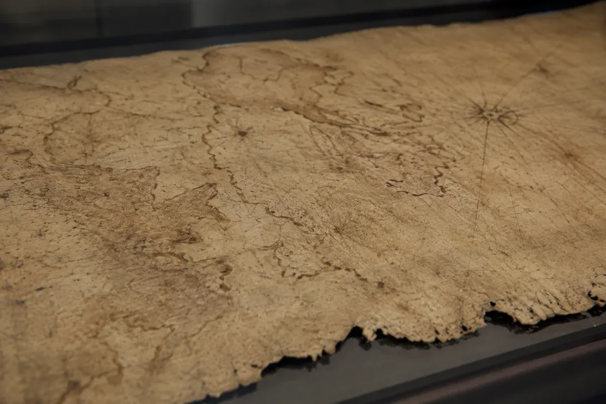
The map is a fragment of gazelle-skin parchment held in Istanbul, now listed on UNESCO's Memory of the World Register.
He published the full case in 1966, in a book called Maps of the Ancient Sea Kings.
The claim required Antarctica's coast to have been ice-free at a time when humans could have mapped it.
The continent's ice sheet formed roughly 34 million years ago, during the transition from the Eocene to the Oligocene epoch.
So Hapgood needed outside validation, and he went looking for it at the source most likely to be believed: military cartographers.
Reading the Letters Again
Ohlmeyer's original 1960 letter and Burroughs's 1961 letter have been reproduced for decades as proof that the U.S. military verified Hapgood's theory. Read closely, they don't do that.
Both are reproduced in Hapgood's own book. What they are is the opinion of two officers writing to Hapgood.
They are not a study submitted for review, and not a position adopted by the Air Force as an institution.
And the data behind the famous line was thin. The comparison rested on a seismic profile taken by the Norwegian-British-Swedish expedition of 1949, and critics have argued that Hapgood and Ohlmeyer simply had too little data to match a coastline against the terrain beneath the ice.
The map's own marginal notes are worth reading closely.
In his own marginal notes, Piri Reis attributes the southern coasts to Portuguese voyages; note VIII describes a Portuguese ship driven south by a storm, which came upon a shore and naked people. No legible note mentions Antarctica.
To be fair to both sides: only a third of the map survives, so nothing can be said about the missing part. But on the part that does survive, the admiral accounts for the southern coasts with Portuguese voyages. Ice, an ancient people, and a lost continent do not appear in those notes at all, and that is the very evidence the theory would need most.
The Piri Reis Map Behind the Letters
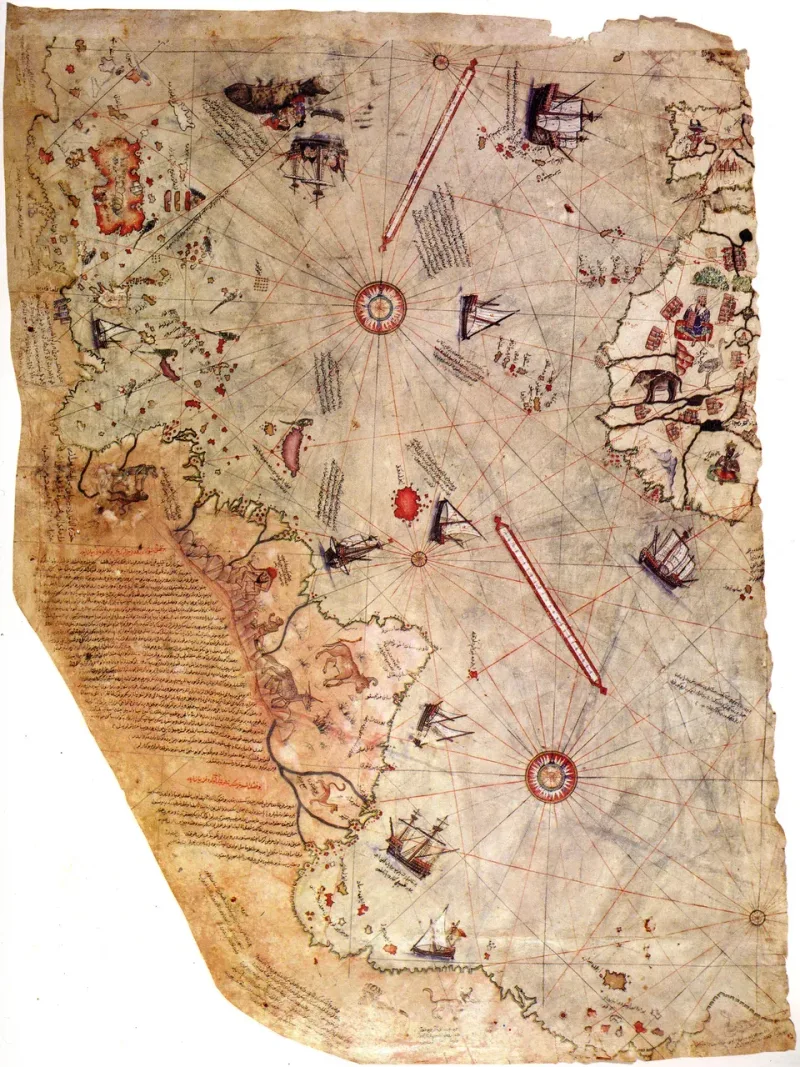
Piri Reis was an Ottoman admiral, navigator, and cartographer, and the nephew of the corsair Kemal Reis.
In 1513 he drew a world map on a single sheet of gazelle skin, compiling it from roughly twenty earlier charts he named himself: a lost map by Christopher Columbus, an Arab map of India, and Portuguese nautical surveys.
He also names eight so-called "Jaferiye" charts, which he says the Arabs call by that name and which he describes as drawn in the age of Alexander; none of them is known from any surviving source.
He gave it to Sultan Selim I in 1517, and it then dropped out of the historical record entirely. It was not rediscovered until 1929, when a cataloguing project at Istanbul's Topkapı Palace turned up a neglected bundle of maps that included it.
Only about a third of the original sheet survives.
None of that is contested. What's contested is a curved line in the lower part of the surviving fragment: the piece Hapgood decided was Antarctica.
Why Cartographers Don't Buy It
Historians of cartography have offered two explanations that require none of Hapgood's assumptions.
Gregory McIntosh's detailed study of the map lays out the first, backed by criticism from geologist Steven Dutch: the disputed coastline is a distorted stretch of South America's own eastern coast, specifically Patagonia and Tierra del Fuego, rotated and bent to fit what remained of the parchment.
The second explanation doesn't even require a mapping error.
Renaissance cartographers routinely drew a landmass called Terra Australis at the bottom of their world maps, not because anyone had seen it, but because contemporary theory held that a southern continent had to exist to balance the land in the northern hemisphere.
Piri Reis had good reason to include one. So did most of his contemporaries.
UNESCO's own register, which lists the map as world heritage, does not dispute that: its description calls it one of the earliest works showing Terra Australis.
One contemporary of Piri Reis makes the Terra Australis point better than argument alone can.
Around 1531, French mathematician Oronce Fine drew a heart-shaped world map that Hapgood later presented as a second piece of evidence.
Fine's map shows the same southern landmass, drawn the same way: Terra Australis, put there because the cosmography of the day demanded a southern counterweight, not because anyone had charted it.
Hapgood read it as Antarctica, and his own description of the mismatch was milder than what he is often credited with: a mapmaker who misplaced the pole by "a few degrees," and a circle of latitude drawn in the wrong place that "would have exaggerated the size of Antarctica about four times."
If the southern continent is a convention rather than a record, the map proves only that Fine drew what his century expected to find there.
The Twist Underneath the Ice
Antarctic research did eventually turn up something that sounds, on first hearing, like it supports a version of Hapgood's instinct: an ancient catastrophe buried under the ice.
It isn't the one he was looking for.
In 2006, a team led by Ralph von Frese at Ohio State University used gravity data from NASA's GRACE satellites to identify an anomaly in Wilkes Land, East Antarctica: a structure roughly 480 kilometers wide, sitting about 1.6 kilometers below the surface.
If it's an impact crater, its estimated age is about 250 million years, which would put it near the Permian-Triassic extinction, one of the largest die-offs in the planet's history.
The asteroid behind it would have been perhaps 50 kilometers across, several times the size of the one blamed for killing the dinosaurs 66 million years later.
A 2018 study in Earth, Planets and Space described its gravity analysis as a plausible confirmation of an impact origin, though the structure's nature is still debated.
But whether it is a crater or something else, the timeline rules out Hapgood by a margin of hundreds of millions of years. That is nowhere close to the window his theory needs.
Hapgood's own number was about six thousand years. On the strength of three sediment cores from the Ross Sea, he concluded that the warm period ended "about 6,000 years ago, or about 4000 b.c.," and that the mapping had therefore to have been done at least that long ago. For the Queen Maud Land coast in particular, he allowed a date as recent as about 1000 b.c.
A further leap sometimes attached to this story, tying the crater to giants or lost megaliths, has no documented source behind it at all.
The quoted line is still online, still screenshotted, still cited as if the 1961 letter that carried it, signed by Captain Lorenzo W. Burroughs, chief of the unit's Cartographic Section, settled a question that geology had already closed.
The admiral's own notes on the parchment attribute the southern coasts to Portuguese voyages; the rest he compiled from the roughly twenty charts he had before him that year.
SOURCES
- UNESCO Memory of the World Register — Nomination Form: The Piri Reis World Map (1513)
- Yusuf Akçura, Piri Reis' Map (1935), English translation, notes VI and VIII
- Gregory C. McIntosh, The Piri Reis Map of 1513, University of Georgia Press (2000)
- Harold Z. Ohlmeyer (6 July 1960) and Lorenzo W. Burroughs (14 August 1961), letters to Charles Hapgood, reproduced in: Hapgood, Maps of the Ancient Sea Kings, Note 22, pp. 243–245
- Frank Lestringant & Monique Pelletier, "Maps and Descriptions of the World in Sixteenth-Century France," in David Woodward (ed.), The History of Cartography, Vol. 3, Part 2, University of Chicago Press (2007), pp. 1464–1467
- Charles H. Hapgood, Maps of the Ancient Sea Kings, E. P. Dutton (1979); reprint Adventures Unlimited Press (1996) — non-peer-reviewed work, cited for Hapgood's own claims and for biographical details (pp. 79, 87–88, 93, 98, 186, 190, 210, 216, 247)
- Bad Archaeology — The Piri Re'is map (critical analysis; source of the point that the seismic comparison rested on too little data)
- von Frese, R. R. B. et al., "GRACE gravity evidence for an impact basin in Wilkes Land, Antarctica," Geochemistry, Geophysics, Geosystems, American Geophysical Union (2009) — peer-reviewed
- Klokočník, J., Kostelecký, J. & Bezděk, A., "On the detection of the Wilkes Land impact crater," Earth, Planets and Space, Springer (2018) — peer-reviewed
- Ohio State University News — Big Bang in Antarctica: Killer Crater Found Under Ice (2006)
- Coxall, H. K., Wilson, P. A., Pälike, H., Lear, C. H. & Backman, J., "Rapid stepwise onset of Antarctic glaciation and deeper calcite compensation in the Pacific Ocean," Nature 433, 53–57 (2005) — peer-reviewed source for the ~34-million-year ice-sheet claim
Aron Corvin
A researcher of the unknown who loves a good story, but doesn't sell sensationalism. I research every topic in detail before I publish it. If you enjoy what I write, your support would mean a lot and help me keep going.